Northaven Trail Map – Dallas Walking, Running & Bike Trail
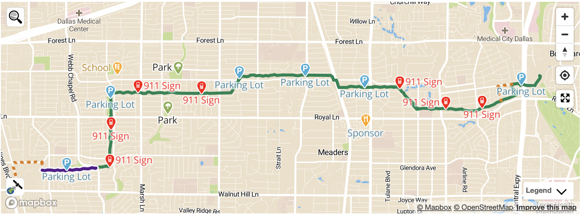
This interactive Northaven Trail map shows the full route of the Northaven Trail in North Dallas, Texas, including access points, bridges, nearby streets, and points of interest. The trail is a paved, shared-use path designed for walking, running, and biking.
Northaven Trail Map View
List of Trail Points of Interest
Northaven Trail Access Points
The Northaven Trail can be accessed at multiple locations across North Dallas. Select an access point below to learn more about nearby neighborhoods, amenities, and trail connections.
Is the Northaven Trail paved?
Yes. The Northaven Trail is fully paved and suitable for walking, running, biking, strollers, and wheelchairs.
What can you find on the Northaven Trail map?
Trail route and length
Bridges and creek crossings
Entry points and neighborhood access
Drinking fountains and rest areas
Gardens and murals